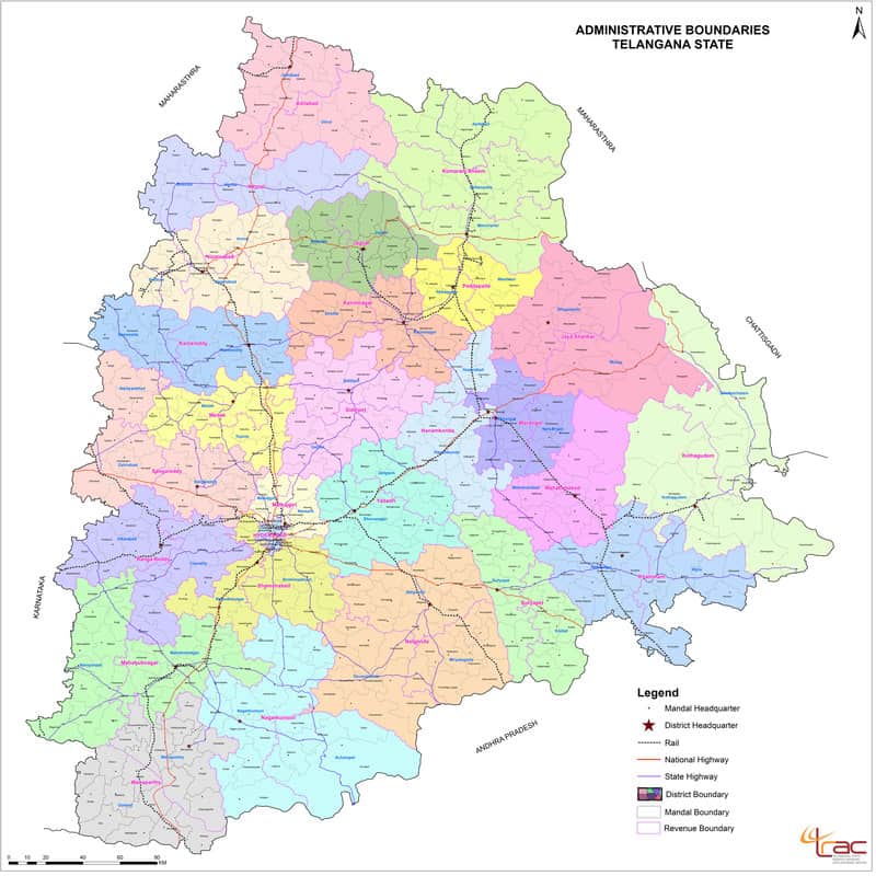
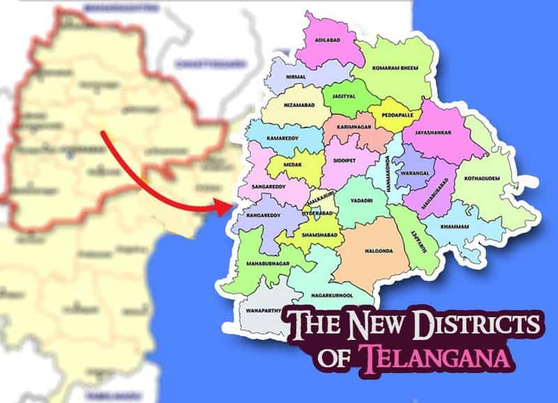
After a long tedious processes, proposals and discussions, the Telangana Govt. has come up with the maps of the 27 proposed districts, 10 existing and 17 newly proposed districts. The maps have been made available for the public to review and also provide and further suggestions/objections.
The maps have been made available on New Districts formations for Telangana. the maps are have been made available in the public domain for the people to provide their objections/suggestions, if any on the re-organisation of existing or creation of any new ones.
The Telangana Govt. has announced that the proposed districts would come into existence on October 11, which is Dussera. The designing of the maps have been done by CCLA Raymond Peter with the help of Telangana Remote Sending Application Centre. The location maps give all the details from revenue sharing, railway lines, road ways to Assembly constituencies. While already suggestions and objections have already started to pour in, Karimnagar records the highest number of suggestions/objections with 1,572 and Adilabad with the least of 143 suggestions/objections.
The new consolidated map comprising the 27 districts :

The details of the new 27 maps are here :
1. ADILABAD DISTRICT
2. HANAMKONDA DISTRICT
3. HYDERABAD DISTRICT
4. JAGITYAL DISTRICT
5. JAYA SHANKAR DISTRICT
6. KAMAREDDY DISTRICT
7. KARIMNAGAR DISTRICT
8. KHAMMAM DISTRICT
9. KOMARAM BHEEM DISTRICT
10. KOTHAGUDEM DISTRICT
11. MALKALGIRI DISTRICT
12. MAHABUBABAD DISTRICT
13. MAHABUBNAGAR DISTRICT
14. MEDAK DISTRICT
15. NALGONDA DISTRICT
16. NAGARKURNOOL DISTRICT
17. NIZAMBAD DISTRICT
18. NIRMAL DISTRICT
19. PEDDAPALLE DISTRICT
20. RANGAREDDY DISTRICT
21. SANGAREDDY DISTRICT
22. SHAMSHABAD DISTRICT
23. SIDDIPET DISTRICT
24. SURYAPET DISTRICT
25. WANAPARTHY DISTRICT
26. WARANGAL DISTRICT
27. YADAGIRI DISTRICT
All Images : Source

